Ah, September in Central Oregon... the air crispens to a nice cool temp, the tourists start to depart back to their homesteads and off of our local roadways, and the skater children go back to school... flat billed hats, long unruly hair, and all. Really, it's a nice time of year. Still sunny, but things start to slow a little. It's a pace I like.
 The photograph above is taken from a spot off of Mt. Washington drive. There are some trails here and pretty neat views. The foot traffic is light, and I think it's one Bend Oregon's lesser known spots. This shot is of the trail.
 In this picture (above), you can see Bend from a bird's eye view. Notice the Old Mill smokes stack, dwarfed, off in the distance? You can see more of the West side from this spot.
 This photograph is from a few feet down the trail. It's still off to the same side as the last. From here you can spot Pilot Butte rising up from Bend's landscape.
More Photos:


 These next two (below), were shots from the same spot I was at. I kind of liked the landscape and tried to capture some interesting shots from different angles. The first was of a large rock laying in the sage. The second, some yellow wildflowers (or weeds) in front of a large stone. The darkness of the stone worked well to accent the yellow on the buds of the plant.


 If you were to turn right on Cooley Road, you'd pass this old boarded up farm house. It's off to the right hand side of Cooley, almost immediately after you turn onto the street. The house is abandoned (possibly foreclosed...) and I though it'd be an interesting landscape style of photo to take. The trees helped to add some character to the photograph, or so I thought.
 The camera didn't quite capture the mountain that appears to be at the end of Cooley Road, the way I had hoped it would. Now, there really isn't a mountain at the end of Cooley, but standing where I was, it was sort of an optical illusion that appeared to be so. Standing in middle of road on Cooley, the asphalt appears to run on into eternity. I had hoped to capture that feeling here, but the image just didn't quite get there.
 This is the Welcoming sign to Bend Oregon as you come in to town from Sisters & Tumalo on Highway 20. According to the sign that stands today (August 25, 2009), Bend's population is 80,995. This sign is just off Cooley road, and the mall lies just off to the South East of here.

 This photo is taken of the left fork or the paved route. By following this you actually walk away, sort of, then hairpin back to road. This will keep you on the paved portion of the road to the top, rather than the dirt trail.

 This image is on the decent. Rounding the first corner as you leave the viewing area, you met by a spiraling downward road. I thought this old snag was kind of interesting, so I snapped a picture of it.
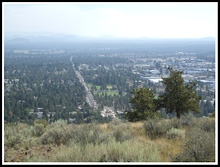 As you round the old snag and walk down a couple feet, if you turn to your left, you can see all the way down 15th Street. It looks off to the South East. You can see by this photo it's kind of a smokey August summer.
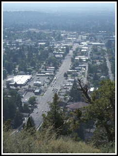
 This photo is of Pilot Butte Middle School's track. It kind of stick outs against a lot of the Central Oregon landscape. This is just off Neff Road, and one of several middle schools in Bend.

 My final shot is of Highway 20 Eastward. You can see Smolich Motors, and Hertz in this photo. Follow this Highway East and you'll head toward Prineville, Burns, and Idaho.

 These are photos of an old Chinese restaurant in Bend, called the Shanghai Garden. It was a well known place for years, but now is out of business. An empty building and for lease signs are now all that remain of this once busy restaurant...


 This building was (for a long time) a local pool, spa, and stove place. I remember going here once or twice as a kid with my parents. A large pool was out front with a fountain and an over-sized kid's play floaty could often be seen covering the sidewalk most summers. Now... an empty building and lot.


